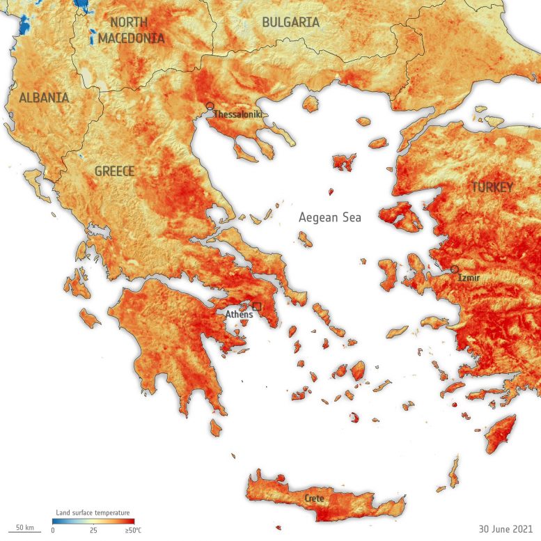
The map here was generated using data from Copernicus Sentinel-3’s Sea and Land Surface Temperature Radiometer. While weather forecasts use predicted air temperatures, this satellite instrument measures the real amount of energy radiating from Earth – and dipicts the real temperature of the land surface. The Copernicus Sentinel-3 satellites also carry camera-like instruments, which captured smoke billowing from the fires in Turkey on July 30.